
ALP TEKİN OCAK
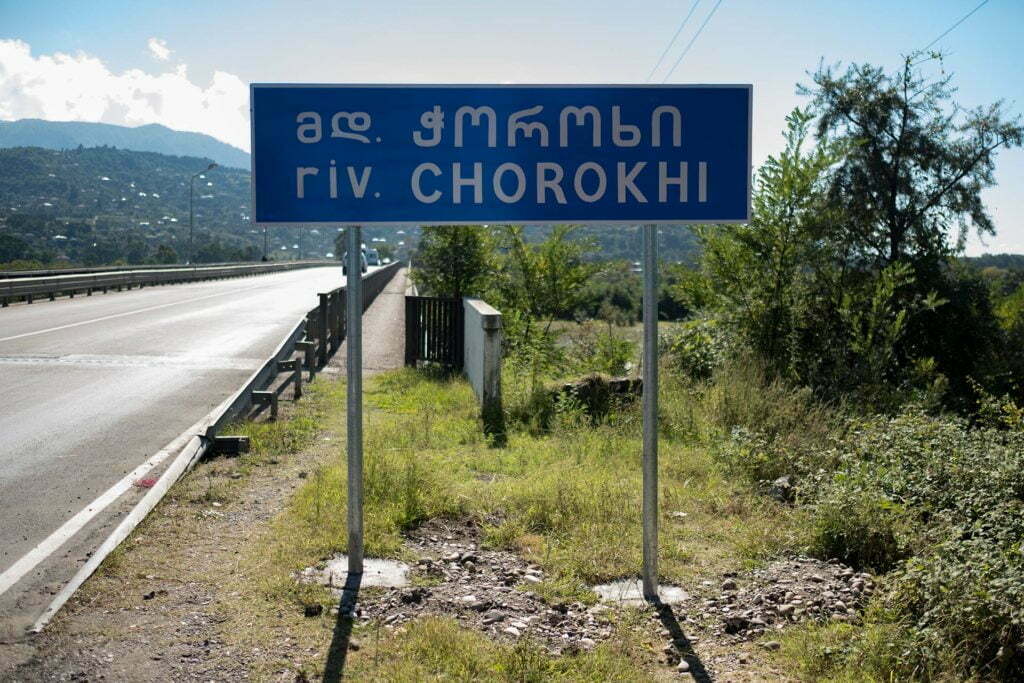
Our aim in the basin study conducted by the Center for Spatial Justice (Mekanda Adalet Derneği – MAD) in the fall of 2019 was to follow the Çoruh River, one of Turkey’s most important transboundary water assets, from source to estuary in order to build a “river profile” and gain a better understanding of the current situation. Our trip started in Bayburt, taking us through İspir, Yusufeli, the Artvin Center and Borçka to end in Batumi.
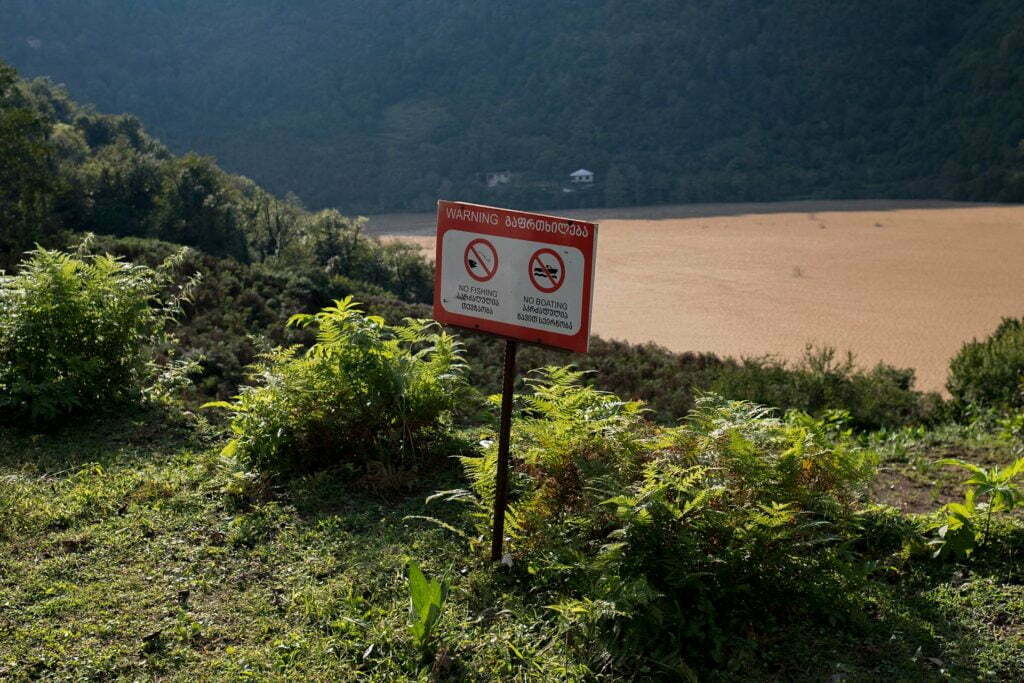
What did Georgians make of Turkey’s attitude as the perpetrator of human interventions that amounted to veritable ecocide all along the Çoruh River, born in Turkey and meeting the sea in Georgia after covering a distance of 438 kilometers? Was the Çoruh as much a Georgian river in the minds of those in Turkey as it was a Turkish river? At a point where dam and hydropower plant projects have skyrocketed as a result of Turkey’s reduction of almost all of its water resources to nothing but hydraulic potential due to privatizations in the energy sector and development policies in recent years, didn’t the fact of the Çoruh being a transboundary river bring projects upon it into the purview of international law? Had transboundary environmental impact assessment procedures been carried out in the preparation and implementation stages of these projects? These were the questions we kept in mind as we collected stories of destruction and hope during our surveys.
The last 20 years have seen the completion of six dams on the portion of the Çoruh that lies within Turkey’s territory, while two are under construction and two more are out for bidding. As it continues to attract such large-scale designs, the question is, what kind of standing does the Çoruh River have in international law?
We must consider the Çoruh a “transboundary” river. Rivers in international law are categorized as:
a) Domestic rivers, which fall wholly within the sovereign borders of a single country.
b) Transboundary rivers, which cross at least one political border from source to estuary.
c) Shared rivers, which no nation-state can claim sole sovereignty over.
The Convention on the Law of the Non-Navigational Uses of International Watercourses adopted in the UN General Assembly in 1997 and the Convention on the Protection and Use of Transboundary Watercourses and International Lakes adopted in Helsinki in 1992 are the first international instruments providing a legal framework for rivers.
Though a variety of different approaches have been taken by international law on the allocation of riparian rights for transboundary waters in the past including the Doctrine of Absolute Sovereignty, the Doctrine of Absolute Territorial Integrity, the Doctrine of Prior Appropriation and the Doctrine of Equitable Apportionment (or Equitable, Reasonable and Optimal Utilization), today it is possible to say that the principle of “equitable utilization” has been accepted as a general rule.
The first legal regulations on the Çoruh are the Treaty on the Beneficial Uses of Boundary Waters (known as the ‘Kars Protocol’) signed in Kars on January 8th, 1927, and the Additional Protocol on the Construction of the Sardarabad Dam between Turkey and the Union of Soviet Socialist Republics (USSR) controlling Georgia at the time, as well as the agreement dated March 7th, 1990, signed with Georgia following the dissolution of the USSR.
According to these aforementioned treaties, both parties agreed to share the waters of rivers, streams and creeks constituting boundary waters equally on a fifty-fifty basis, to set up measurement stations in order to control water levels in these rivers, to take precautions to safeguard the interests of the other party in the case of building a dam on any of these waters, and allow the free flow of the necessary amount of water through the dam in question. Both parties also undertook to compensate any damages suffered by the other party despite precautions taken.
It was also brought under contract that all facilities to be built on these rivers would be built in collaboration to prevent or adjust any shift in the riverbeds. With these treaties, it was stipulated that parties would not act unilaterally with regards to the waters in question, but rather collaborate in the planning and preparation stages of projects as well as the construction of facilities[1]
Though the agreement is that both countries must negotiate projects to be carried out on the Çoruh River based on the principle of “fifty-fifty” benefit, the current practice shows that Turkey has neglected to take any measures to preserve the ecological integrity of the basin, failed to engage in collaboration with Georgia across the border, and has upheld almost none of its commitments under international law.
Throughout our week-long field study, we witnessed scenes of destruction – and the co-riparian Georgia and its people who share the Çoruh with Turkey weren’t even part of the picture. Public authorities in Turkey, in the meanwhile, were busy building dams and hydropower plants (HEPPs) at breakneck speed all over the country’s river with the fourth largest hydraulic capacity.
At this point, without drawing things out any further, I’d like to say that the best response to this dominant attitude towards the basin is to be found in a ruling by a local administrative court we came across in the anti-hydropower struggle:
[The Court finds] that the sole purpose of a water basin is not to generate electricity, that this is only one of its many uses, that the natural integrity of the basin and the opportunity for otherwise beneficial uses must be preserved while carrying out human activity, that structuring a basin entirely around the aim of generating electricity and doing this repeatedly according to a narrow-minded project that lacks depth constitutes the gravest damage to be inflicted on a basin, and that this may have unchecked and irreversible consequences for basins where HEPP projects are being carried out. [2]
In terms of basin management strategy, rivers should be approached as natural assets that connect rather than separate. Today, human geography has chosen the easiest course of action and marked rivers as natural boundaries separating cities and countries – whereas rivers might also inspire a variety of management systems being the bodies of water that create a shared ecosystem and basin. I once heard an ecologist say: “Wouldn’t it be wonderful if we built river cities?” Perhaps the answer is, in fact, in the unifying power of rivers.
[1] Please refer to Duygu Doğu Kırkıcı’s expertise thesis titled Sınıraşan Sular Bağlamında Türkiye, Suriye ve Irak İlişkileri (Turkey-Syria-Iraq Relations in the Context of Transboundary Waters). Orman Ve Su İşleri Bakanlığı (Ministry of Forestry and Water Affairs), 2014
[2] Rize Administrative Court 2008/369 E. 2010/311 K.